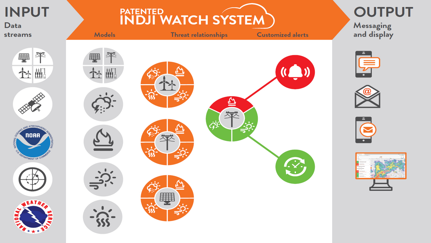
Forecast Radar
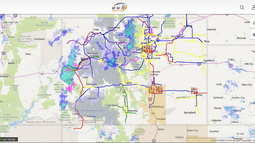
Knowing when your assets are in the path of an approaching storm is critical for making decisions about the grid and team safety. Indji Watch employs NOAA’s real-time, 3km High-Resolution Rapid Refresh (HRRR) weather model. Developed by Earth Systems Research Lab in Boulder, Colorado, this atmospheric model is the only weather model in the world to update every hour. It can forecast the projected path of storms in the upcoming eight hours with greater accuracy than any other source.
Forecast Lightning
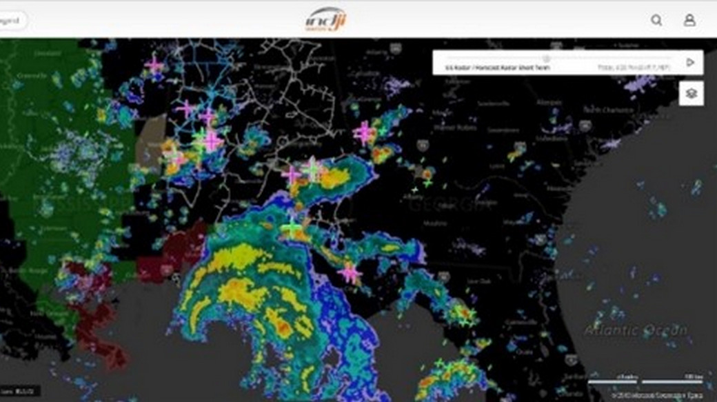
Lightning can cause a line fault, damage equipment and more importantly, injure operators working on a line. For these reasons, Indji Watch has supplemented our world class real-time lightning alerting with a Forecast Lightning animation tool. This tool takes advantage of NOAA’s HRRR weather model which provides a forecast of lightning development and movement over the next eight hours and the density of the lightning storms. The Indji Watch Forecast Lightning animation layer will allow operators to assess the movement and intensity of lightning storms in relationship to their grid assets for potential outage planning and permit construction and field maintenance crew managers to better schedule their human and material resources while minimizing risk to employees.
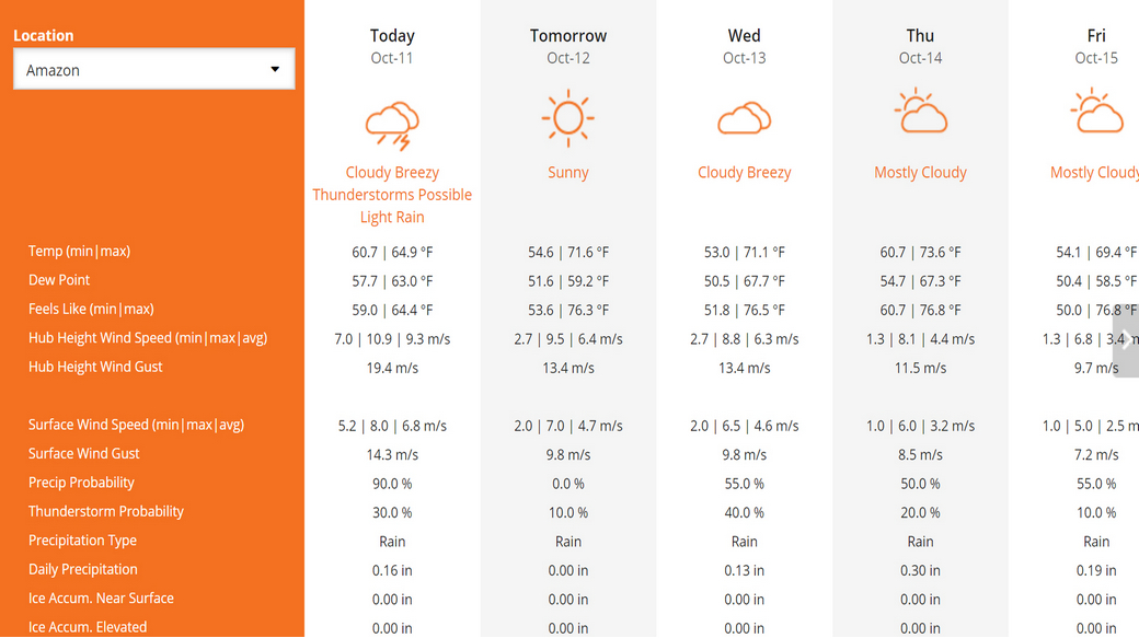
Forecast Summary
The Forecast Summary will provide you with a seven-day forecast of multiple weather parameters including extreme temperature, high winds, and ice accumulation among others. The forecast locations are chosen by you to better reflect the forecasts for your grid assets and known problem areas within the service territory. This can be viewed daily or hourly for a seven-day time period. The weather forecast is updated hourly using the latest weather observations, radar data and model information so you can confidently schedule maintenance and repairs.